
Great allies of forest planters, satellites that collect data from the Earth help strengthen the sector and protect ecosystems
Whether forests are close by or far away - that is, in urban centers or in remote regions isolated from civilization - wooded areas have a much greater impact on everyday life than most people realize.
Essential for maintaining the planet's balance, these natural and environmental assets perform ecosystem services that go far beyond providing resources such as wood and food: they are home to most of the earth's biodiversity, help regulate the climate (by absorbing carbon dioxide from the atmosphere), provide water, protect the soil from erosion and are sources of medicines and bioactive compounds for human health, among countless other benefits.
In other words, ensuring the effectiveness and sustainability of forests means safeguarding the existence of billions of people and countless other species. And thus guaranteeing the future of the planet!
But what are forests?
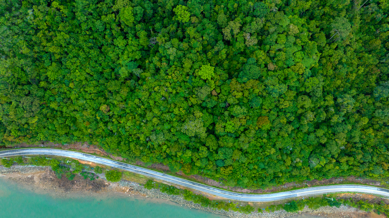
When we imagine a forest, an “endless” cluster of majestic trees immediately comes to mind. Such as the Serra do Mar, a mountain range running parallel to the central-southern coast of Brazil, with approximately 386,000 hectares spread over 1,500 km, and which represents the largest biological corridor in the Atlantic Rainforest.
Or the fantastic Amazon. Its total size of around 674 million hectares (6.74 million km²) stretches across 9 South American countries: Brazil, Bolivia, Colombia, Ecuador, Guyana, French Guiana, Peru, Suriname and Venezuela - Brazil being home to most of the forest, around 421 million hectares (61%).
However, according to the Food and Agriculture Organization of the United Nations (FAO), a an area of 0.5 hectares or more (5,000 m²) can already be considered a forest. As long as it is at least 10% inhabited by trees over 5 meters tall, or with the potential to reach those dimensions, and is not predominantly in agricultural or urban use.
In short, although forests can be immense and cover large territories, the size of these wooded coverages varies dramatically. They can be vast biomes covering countless countries or even small areas smaller than an official soccer pitch - which, by way of comparison, is 7,000 m² (about 100 m x 70 m).
And how can these assets of common interest be protected?
Also according to the FAO, which recently released the World Forest Resources Report 2025, Almost a third of the planet's surface (32%) is covered by forests. This figure represents 4.06 billion hectares formed by ecosystems made up of a wide variety of animals and plants, mostly woody and with high canopies, forming what we know as a canopy.
But while on the one hand we should celebrate such forest wealth, we cannot ignore the real dangers that threaten these resources of incalculable economic, social and environmental value on a daily basis. These include deforestation, fires, insects, diseases and severe climatic events.
So how can we protect forest formations 24 hours a day, considering that they are often located in hard-to-reach places?
Traditional approaches to forest monitoring are definitely no longer effective enough to meet today's challenges. And this is where satellite technology becomes a key player in the fight against the climate crisis and other risk factors.
Satellite forest monitoring
Able to collect real-time data on the Earth's atmosphere and surface, orbiting satellites have become great allies in initiatives to protect and sustainably develop ecosystems.
In the case of forests - which, by the way, are the most evolved ecosystems on the planet - remote sensing devices are crucial for the constant and safe monitoring of these heritage sites because:
- They provide a detailed understanding of the dynamics of land use and land cover on a local, regional and global scale;
- They allow tree individuals and any variation in soil and temperature to be recorded and analyzed;
- They allow warning signs (such as environmental degradation) to be identified for immediate corrective action.
In short, more than concise mapping and management, satellite images are vital tools for preventing natural occurrences and human impacts in forest areas. They also complement field measurements.
Software with artificial intelligence for digital forests
A digital platform developed to deliver orbital data in large volumes (Big Data) in an organized, practical and intuitive way, the Forest Watch offers total control, traceability and transparency in the management of public and private forests.
Internationally validated and recognized, the technology uses enhanced algorithms combined with Artificial Intelligence (AI) techniques and Machine Learning capable of transforming satellite information into actionable knowledge.
Our main objective? To leverage the potential for forest expansion around the world, both in production and conservation areas, in synergy with sustainable objectives and the fight against climate change - such as mitigating greenhouse gas emissions, promoting the sustainable use of ecosystems and environmental recovery.
Applications and benefits that make Forest Watch special
Seeking to strengthen strategies for forest growers and forestry managers to overcome challenges, minimize risks and protect investments, Forest Watch integrates innovative tools to:
- Precision remote sensing: monitoring the life cycle of any forest in the world, with real-time data processing for efficient control of the area - which, in time, is one of the biggest bottlenecks facing the sector today;
- Consistent data integration: satellite images and data at different temporal and spatial scales to monitor vegetation health and density, soil quality, water conditions, fires, deforestation and stored carbon, among other measurements;
- Interactivity and comparative analysis: 3D map of the mapped area, with navigation in predetermined indexes and graphics that allow you to observe and evaluate the general condition of the forest and other relevant environmental factors;
- Intensification of production: predictive and qualitative diagnostics to understand tree growth, quality and health, with a view to better management practices, greater productivity and maximum profitability;
- Risk mitigation and forest protection: insights with various levels of detail, in order to prevent climatic variables and human degradation actions from affecting forest development and the maintenance of biodiversity;
- Culture data-driven: more informed and accurate decisions made on the basis of data that is collected, processed and cross-referenced with solidity, security and reliability;
- Market intelligence: platform with an interactive programming interface for easy access to a robust online database, available in several languages, eliminating the need to hardware or frequent visits to the countryside.
By providing digital forests through geospatial intelligence, our technology enables absolutely effective means of planning and conducting forestry activities.
Contact our team today to access these advantages and countless other resources that are readily available on the Forest Watch platform.
Leave a Reply